Scheme Overview

Update - February 2026
From Wednesday 18 February at 7:00 a.m. until Friday 20 February at. 5:00 pm, St. James’ Road will be closed between Ballybane Road to the Bayview Rise Junction.
This closure will be in place for 24 hours a day during these times and is to allow for works on the Ballybane Road and Castlepark Road Cycle Network Scheme. Advance diversion signage is in place prior to work commencing, and diversion signs will be in place throughout the works.
A signed diversion route will be in place, via Walter Macken Road and Michael Collins Road.
The Bus Éireann 405 service will be diverted via Walter Macken Road during this closure period and bus stops will be relocated. The locations of these stops will be advised by temporary signage.
Access to St. James’ Road for residents and businesses will be maintained via Michael Collins Road. Localised access to St. James’ Road for walkers, wheelers and cyclists will be maintained at all times.
We would like to thank road users for their co-operation while works are ongoing.
Document TM011 St James Rd Road Closure.pdf (PDF, 400.96KB)

===
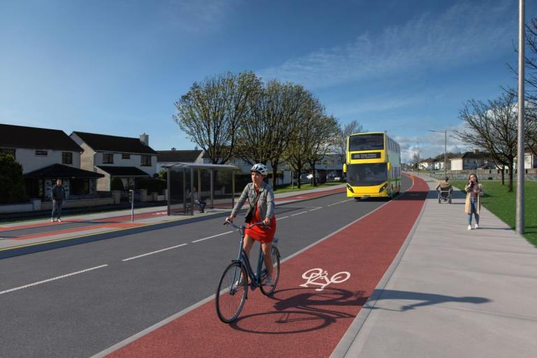
This scheme will provide a safe and attractive cycle route along the Ballybane Road and Castlepark Road, with pedestrian facilities also being constructed.
Ultimately when the routes are delivered, they will improve safety, reduce vehicle speeds, and contribute towards an increased number of trips in the area by pedestrians and cyclists.
Construction on this scheme is ongoing. This webpage will be updated to reflect updates on this scheme as it progresses.
The development will consist of:
- The provision of a 2m protected cycle track and 2m footpath on both sides of Ballybane Road and Castlepark Road, reducing in places where constraints exist.
- Reduction in road carriageway widths (typically 3m wide lanes).
- Junction realignments and the introduction of raised crossings on all side roads to prioritise pedestrian movements.
- Straight through cycle lane/track crossings on all side road junctions to prioritise cyclists’ movements.
- The provision of signalised crossings for pedestrians and cyclists.
- Upgrading of the R865 Ballybane Road / L5029 Castlepark Road junction and L5029 Castlepark Road / R339 Monivea Road junction to signalised junctions with provision for pedestrians and cyclists.
- The introduction of pedestrian and shared crossing points at several locations.
- The provision of landscaping along the routes.
***
Works began in February 2025, and are continuing along both Ballybane Road and Castlepark Road.
Traffic management measures will be in place and some delays are expected. Two-way traffic will be maintained during peak hours on both roads.
Updates from the contractor are being published on the Further Information section of this webpage.
Latest Contractors' Information Leaflet - October 2025


August 2025
Click here to see more previews of this scheme
The site is located as follows:
- R865 Ballybane Road, from its junction with the R339 Monivea Road to a point approximately 130m north of Skerritt Roundabout (R338 Dublin Road).
- L5029 Castlepark Road, from its junction with R865 Ballybane Road to its junction with R339 Monivea Road